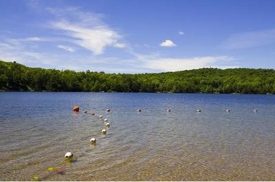
Ada Lake (red star) is a small, glacial lake in northeastern Wisconsin, about 70 miles northeast of the city of Wausau. The western shore of the lake is dominated by houses and cabins of private landowners and the eastern shore is undeveloped land of the Nicolet National Forest, including a state campground. Ada has a maximum depth of 18.3 meters and an average depth of 4.9 meters. The lake covers 73 acres, has 1.6 miles of shoreline, and is home to a healthy population of panfish, bass, and northern pike.
The ranking score is used to determine how "popular" a trip or location is. It is calculated based off of a weighted average of the number of reviews and the user ratings. For example, a location with 2 reviews and an average rating of 5 will have a lower "ranking score" than one with 10 reviews and an average rating of 4. This is because even though the first location has a better average rating, it has not been reviewed as much as the second location, so it is not as "popular". In the future we may modify the ranking score to take in additional factors, such as the number of views, comments, and photos.
Use the buttons above to view a 3D fly through of this location. The first time you will be required to download the Google Earth Plugin, but it is well worth the effort.
Your Address:
Longitude/Latitude:
-88.7370014190674, 45.372347935085
Birds Eye View:
There is no birds eye view for this location
Use the buttons above to change the the birds eye view orientation for this location. You can also pan around the image to view shoreline and surrounding structure.
Topo Map:
Edit Details:
Are we missing information on Ada Lake that you know about? Is our data is inaccurate? If so, please Edit This Location.